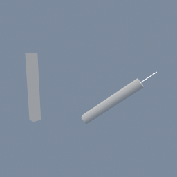
A part built along Y turned to lie along another object's axis, with a roll, by naming the two axes instead of typing an angle.
geo/TransformAlign geo/Line
Documentation / Node reference / geo nodes
A polyline, straight or through the points you give it.
Primitives
With nothing plugged in, this is a straight line: it starts at `origin`, runs along `direction` for `length`, and is cut into `pointsCount` evenly spaced points. **That line is always 2D.** It lies in the XY plane, stores two numbers per point instead of three, and leaves the object matrix at identity. To aim it somewhere else, put a geo/Transform in OBJECT mode after this node; to get a 3D copy, put a geo/DimensionPromote after it.
Plug something in and it becomes the polyline THROUGH THAT INPUT'S POINTS. They are joined up in the order they arrive and nothing else happens to them: no resampling, no smoothing, no point moved. An input that CLOSES ON ITSELF, a geo/Circle for one, comes out closed too: the last segment joins the last point back to the first. `origin`, `direction`, `length` and `pointsCount` are ignored. A geo/Add of hand-placed points into here is the shortest route from a few positions to a drawable polyline.
Each input OBJECT becomes its own polyline, so several objects in gives several out rather than one. Each polyline stands in for the object it was threaded through, so it takes that object's placement and its place in the hierarchy. The dimension comes from each input too: a 2D input gives a 2D polyline, since joining points up cannot make a flat thing three-dimensional.
Use geo/Curve instead when the points are control points to be smoothed or resampled; its SOURCE POINTS method is this node's behaviour, with a tangent attribute on top.
| Name | Type | What it does |
|---|---|---|
| length | Float | How long the straight line is. Ignored when something is plugged in. |
| pointsCount | UInt32 | How many points the straight line is cut into. Ignored when something is plugged in, where the count comes from the input. |
| origin | Vector2 | Where the straight line starts, in its own XY plane. Ignored when something is plugged in. |
| direction | Vector2 | Which way the straight line runs, in its own XY plane. It is normalized, so only its direction matters. Ignored when something is plugged in. |
| asPoints | Bool | Output loose points instead of a polyline of segments. |
Scenes you can open in the editor that teach this node.
A part built along Y turned to lie along another object's axis, with a roll, by naming the two axes instead of typing an angle.
geo/TransformAlign geo/Line
This page is generated from the engine, so it describes the release you can download. The same text is in the editor's Help panel next to the node itself.